Interactive is the ideal solution for large organizations that want to simplify their monitoring services to their users. Interactive is available for a growing number of applications and businesses. The products and services are:
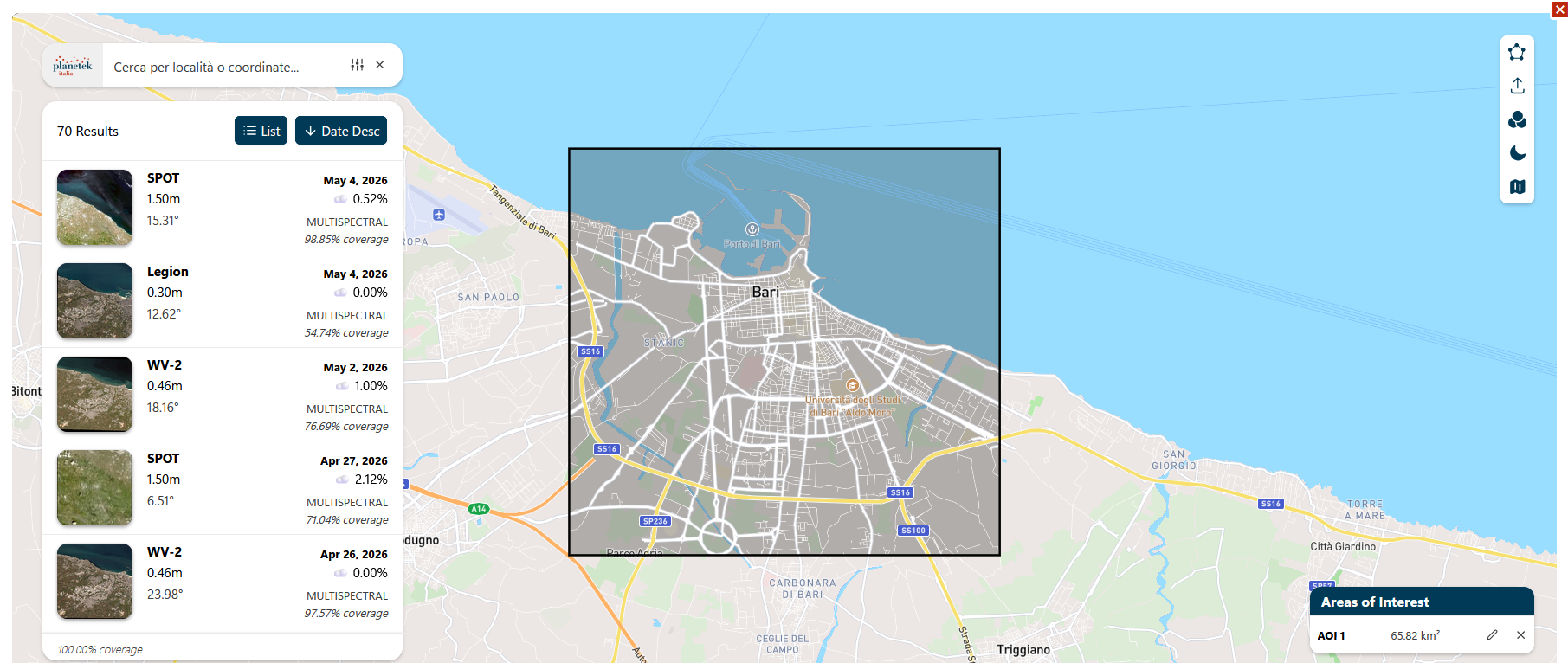
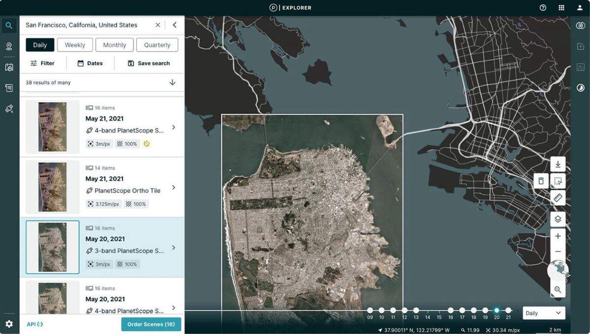
Satellite images via Image Search
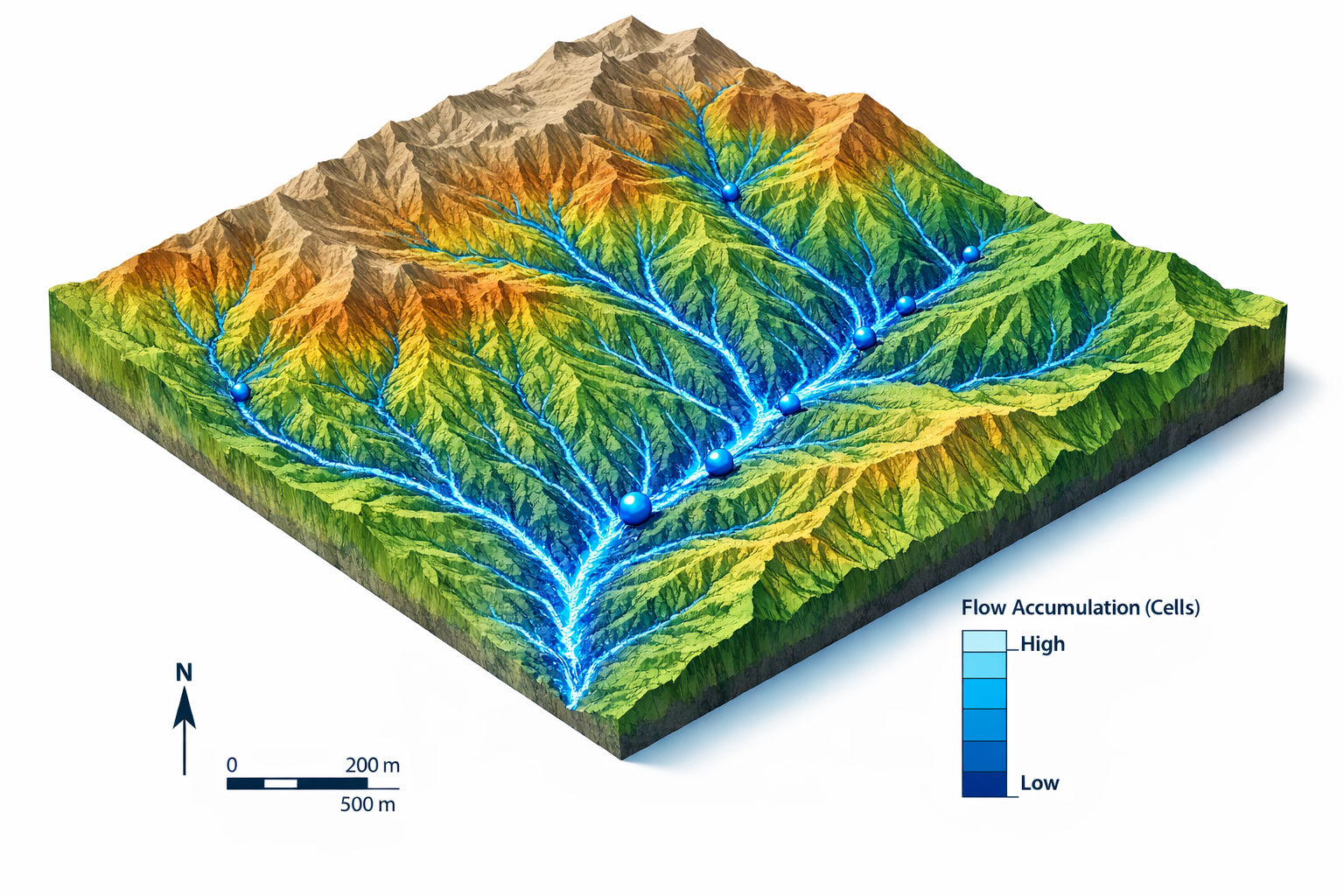
Analysis of maximum flow‑accumulation points derived from a Digital Terrain Model (DTM)
New Collection – Various pixel resolutions (RGB, Bundle)
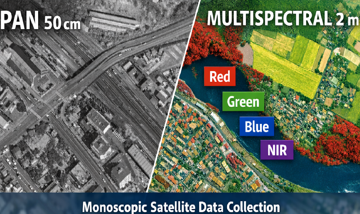
New Collection of monoscopic satellite data with available spatial resolutions range from 15 cm to 1.5 m per pixel in the panchromatic band, plus 4 multispectral bands at 2 m resolution, or RGB.
Images at 15 cm and 30 cm spatial resolution are also available as orthorectified products.
Archive – Various pixel resolutions (RGB, Bundle)
Archived monoscopic optical satellite data. Available spatial resolutions range from 15 cm to 1.5 m per pixel in panchromatic and pansharpened RGB modes, and 6 m per pixel in the 4‑band multispectral mode.
Images at 15 cm and 30 cm spatial resolution are also available as orthorectified products.
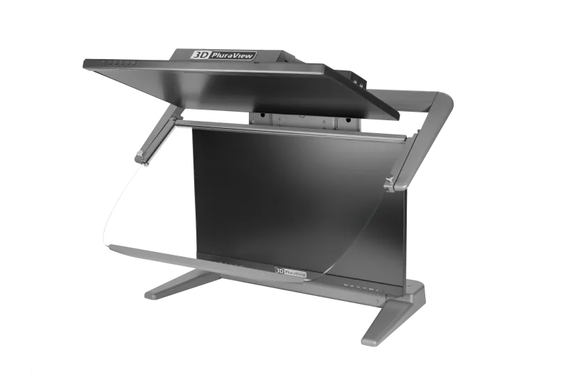
3D Pluralview Monitor 27
Stereo-Monitor 3D PluraView 27″ PROJECT 2.5K (WQHD) – photogrammetric measuring instrument.

EDU Planetek Italia
– EDU Stereo Archive – 30 cm pixel (RGB or 5 bands)
– EDU Stereo New collection – 30 cm pixel (RGB or 5 bands)
– EDU Remote Sensing user license (Erdas Imagine + extensions)
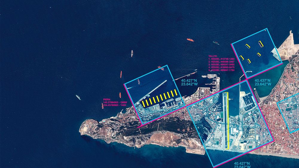
Change Detection Layer between two VHR Orthophotos
Change detection between two orthophotos from different years at 30 cm pixel resolution and/or 15 cm HD.
The analysis records changes related to:
– roads and transportation networks;
– buildings (removed buildings, newly constructed buildings, extensions larger than 5 m²);
– visible earthworks;
– maritime structures (newly built maritime structures, removed maritime structures);
– waste accumulations (cleared accumulations, new accumulations);
– other modifications.
Planetek Italia Quick Start
– Quick‑Start DEM – High‑Resolution Digital Elevation Models with QGIS
– Quick‑Start Hyperspectral – Spectral Analysis with Earthbit
– Quick‑Start QGIS for Earth Observation
– Quick‑Start SAR – Radar Image Processing
– Quick‑Start Thermal – Thermal Satellite Image Analysis with QGIS
DEM – High‑Resolution Digital Elevation Models
Digital Elevation Models (DTM, DSM) can be provided in two ways:
– In‑house processing
– Data available from external Data Providers
Road Pavement Condition Assesment
Mapping and classification of road surface conditions using very high‑resolution (VHR) Earth Observation satellite data. The service includes the production of:
– WV‑3 image orthomosaic;
– preliminary and final mapping of pavement ageing conditions;
– mapping of cobblestone (pavé) presence/absence.
Introduction Course to ERDAS IMAGINE and to geospatial data management
This course provides participants with a foundational understanding of Erdas IMAGINE, a leading software for remote sensing and geospatial analysis. It introduces essential concepts and workflows for managing, processing, and visualizing geospatial data.
Planetek for Arpa Lombardia
– Mono Archive – 30 cm pixel (7 bands)
– Mono Archive – 30 cm pixel (9 bands)
– Mono New Collection – 30 cm pixel (7 bands)
– Mono New Collection – 30 cm pixel (9 bands)
– Planet Monitoring SkySat Flexible Tasking
– Stereo New Collection – 30 cm pixel (7 bands)
– Stereo New Collection – 30 cm pixel (9 bands)
Planetek for INAIL
– Archive – 30 cm pixel (9 bands) or SWIR (3.7 m)
– New Collection – 30 cm pixel (9 bands) or SWIR (3.7 m)
Training and consultancy
Training and consultancy days delivered by Planetek’s expert team.
Planet Monitoring
Planet Monitoring 12-month subscription:
– 20,000 tiles per month for visualization;
– 2,000 km² of download quota;
– technical support throughout all pre‑activation and post‑activation phases.
Planet Monitoring download top‑up:
– provides an additional 900 km² of download capacity within the active Planet Monitoring subscription.
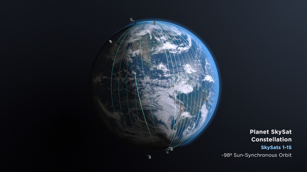
Planet SkySat Flexible Tasking | 1‑year subscription (1 license)
Flexible Tasking.
The customer purchases a tasking bucket and can define the AOI/TOI at the time of request.
SkySat acquisition: 1,700 km², with a minimum acquisition area of 25 km².
Living Library Airbus | 1‑year subscription (1 license)
– 700 kmq SPOT
– 150 kmq Pléiades

Erdas Imagine Professional
Erdas Imagine Professional – user license
Erdas Imagine Professional – maintenance
– Renewal of ERDAS IMAGINE Professional maintenance for 12 months
– Restoration of ERDAS IMAGINE Professional maintenance
Rheticus Acquaculture
Farm monitoring and identification of best harvesting and selling times for optimizing aquaculture activities.
Rheticus Building Check
Periodic reporting of the stability of buildings, classified on the basis of the stress level associated with measurements of displacements and accelerations over time.
Rheticus Displacement
Periodic monitoring of land surface movements due to slow landslides and/or subsidence in urban and suburban areas with definition of the magnitude of displacements and accelerations over time.
Rheticus Marine
Periodic monitoring of coastal water and freshwater quality linked to eutrophication, and marine resource exploitation.
Rheticus Network Alert
Periodic monitoring of water and sewer networks for the detection of potential failures linked to ground movements and displacements.
Rheticus Oenoview
Satellite support for winegrowers and winemaking cooperatives for the optimisation of their activities, the improvement of productivity and quality.
Rheticus Safeland
Periodic reporting of land stability through segmentation of the area of interest and automatic classification of each individual portion based on measured trends and anomalies.
Rheticus Safeway
Periodic reporting of the stability of road infrastructure such as roads, railways and airports. The segmented infrastructures are classified on the basis of speeds and acceleration measured over time.
Rheticus Urban Dynamics
Urban dynamics monitoring to identify anthropogenic changes: soil sealing, urban sprawl, illegal building, urban heat islands.
Rheticus Wildfires
Burnt area detection, fire severity classification, vegetation regrowth monitoring and detection of potentially illegal infrastructure activities.